Thursday, November 23, 2006
Save the Rio Futaleufu!
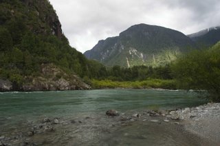
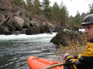
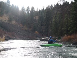
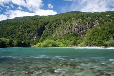
A sunny day on the Rio Futaleufu
Photo courtesy of Jason Bates
This spring I traveled South to Chile for some good ol’ whitewater kayak training with the New River Academy. While in Chile, I stayed at the surf- town of Pichilemu, Pucon -“the Hollywood of Chile”, and lastly-the Rio Futaleufu. To get to the Futa, you have to take a twelve hour, overnight ferry ride from Puerto Montt, rent a bus from Chaiten, and drive two hours down a windy, gravel road….with lots of potholes. Emphasis on LOTS. Watch out for roaming cows in the road and avoid driving off a cliff.
Chileans refer to the area of Patagonia as a country all its own. Glacier capped peaks surrounded my campsite on the Rio Futaleufu where I stayed for roughly two weeks. Futaleufu is a Mapuche (Indian) word meaning “grand grand waters”. It was first discovered in the 1980’s by kayaking enthusiasts based on the Bio Bio River. The headwaters of the Futa are in Argentina’s Los Alerces National Park. The river contains some of the world’s best “big-water” paddling and each year thousands of tourists flock to Patagonia to experience the thrill of the river. Some call it the Grand Canyon of the Southern Hemisphere. My group and I paddled every section, from the Class five Inferno Canyon to the mellower class three rapids that flowed past the campsite.
Photo by: Christina Russell
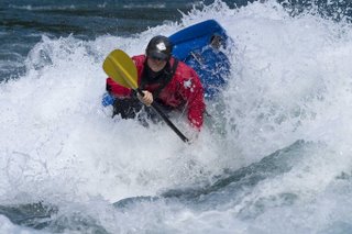
Alex Mohn workin' the Vision 44
Photo by: Christina Russell
Me surfin' on Disco Biscuit :D
Photo by: Jason Bates
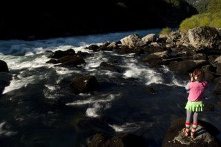
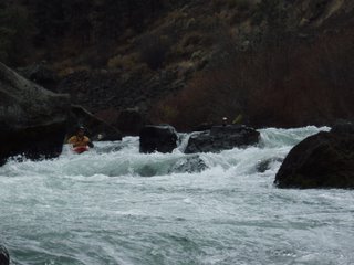
yes...here I am photographing Mundaca....a HUGE breaking wave/hole/thing....
Photo by: Jason Bates
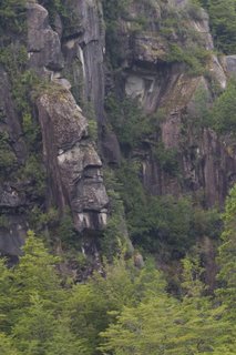
The Old Indian in the rock...
Photo by: Christina Russell
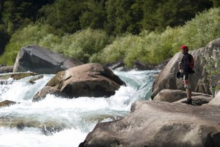
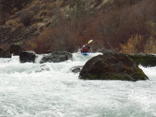
Mark P. scouting Class V Terminator Rapid
Photo by: Christina Russell
What most people don’t know is that the river might not be around for much longer. Towards the end of my stay, I sat down to talk with the head of the environmental organization known as FutaFriends. It is a non-profit group that focuses on the preservation of the Rio Futaleufu.
So here’s the scoop:
The company known as Endesa: Empresa Nacional Developmente Energie Societe Anonyme, based out of Santiago, has had its eyes on the Futaleufu valley for some time now. High-volume rivers such as the Futa are quite attractive to hydro-electric companies. In 1994, Endesa proposed the building of dams on the Futaleufu. This was met with resistance from farmers, ranchers, and Futa Friends. They successfully fended off Endesa-yet only temporarily.
In 2004, the company returned and announced its plans to build once again. Over the ten year construction hiatus, Endesa secured the water rights (in 1998) in the Futaleufu Valley through judicial avenues. If all goes according to plan, three power-stations will be constructed on the Rio Futaleufu. The project is scheduled to begin within the next ten years. It will produce an estimated 12,000 Mega Watts (Compared to 2800 MW from two dams on the Baker and Pascua Rivers). This is enough power to easily replace the electric system currently in place in Chile and aid Argentina in its electrical shortage.
Endesa believes that water is Chile’s “oil”. However, by damming the Futaleufu, one of Chile’s most beautiful and cherished rivers, will be destroyed forever. Thousands of Chileans who have called the Futaleufu Valley home for hundreds of years will be displaced and out of work. Most locals believe that the implementation of dams will bring jobs and capital…wrong. Endesa has no plans to employ locals, but rather workers from Santiago with experience in dam construction and maintenance.
Not only will the people suffer, but the environment will as well. Power lines must be erected from the River to Puerto Montt- hundreds of miles away which creates substantial environmental destruction and disruption. It requires extensive forest clearing and road construction. The river will be transformed into a lake miles long. If Chile allows the damming of the grand Futaleufu, it’s only a matter of time before more damming projects are legalized in Chile and elsewhere in South America. Currently there are 31 other rivers in Chile on the list for proposed damming- most of which, if allowed, would be constructed within the next ten years.
It is an interesting predicament: Save a part of Chile that is in essence, the spirit of Patagonia, or make money and energy? Odds are not in favor of saving the Futaleufu.
Most argue that these affects are worth the payoff- energy. Energy is needed in the country but there are alternative methods of obtaining it. Wind farms for example could be implemented of the coast. Patagonia, after all, is one of the windiest and stormiest areas in Chile. Why not harness it?
Having read this article, you can make a choice: Do nothing, or decide this is something worth protecting. It is extremely difficult to find more information on this project as Endesa has done a fantastic job of hiding their plans. If you are interested in learning more or helping prevent this, visit www.futafriends.org . The best thing you can do now is tell your friends and make others aware of this issue. Save the Futaleufu and help save the rivers of Chile!
Wednesday, November 15, 2006
Puzzle Time!
I have just returned from a weekend in Hood River after the floods, and let me tell you, It is WET up there! It rained almost the entire time I was there; it would rain for an hour, break for some sun, then go back to a drizzle and maybe break again a little later.
I left Bend, Oregon Friday morning and proceeded to drive the long way there (since 35 is closed) at a pace where my gas mileage would have the chance at being over 16 mpg. SWEET!
Hood River
Photo by: Kim Russell
Got there around the late afternoon—ish (emphasis on the ish), and ended up skipping dinner to watch some flood footage of the area from this past week that my friend Brandon Backman took. Most of the footage I saw was similar to the pictures I posted last week: trees down, once existing roads now non-existing, as well as some awesome footage of some local rivers. (I will try to get the video and post it).
Apparently, the Main Hood River reached flows sweet enough to produce epic waves. In the video, they looked almost Skook-like: big, nice, even pile with great air potential. They looked super fun to go out and surf only till MASSIVE trees and root balls floated by. WHOA! Then there were the trees being cartwheeled underwater that would all the sudden pop up at the wave. Definitely made things look a little less appealing. haha. I guess that with a spotter watching for wood as you took a ride there would be a whistle blown every three seconds or so. WOW. That is a lot of debris!
After watching the video, Brandon and I made plans to paddle the Dee to Tucker section of the East Fork of the Hood River the next morning, watched some more random kayak video, and crashed early. Sweet. We woke up at a good time to rally the East Fork with a crew, only that crew was not happening this morning. Oh well. We went anyway, putting in at the town/bridge of Dee, where we had a 6 mile paddle ahead of us that would only take about an hour tops.
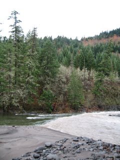
The Confluence of the East Fork (the muddy river in the right of this photo), and the Main (the clear green river on the left side).
Photo by: Kim Russell
This section of river is a big-water class IV fun-run that starts on the East Fork of the Hood and joins the Main Hood River after about three miles. It is hard to even describe this river… At these flows, above 3,000, the river was still coming down from flood stage, so things were super different: The river starts out fairly narrow with no eddies. The upper section feels creek-like with lots of S-turns and what would be steep drops at normal flows. We put-in at Dee to some super muddy water with enough asphalt from the destruction of highway 35 in it to build a whole new highway. Wohoo! Definitely did not want to open your eyes when you rolled. As it was, there was enough gravel being spit out at you at wave crests without the asphalt. Haha. We put-in and paddled this top section super fast (read: lots of water).
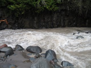
Photo by: Kim Russell
A drop we got out to scout: Around the corner a few days before, there was a HUGE hole, but this time there wasn’t. It’s amazing what floods do. Sweet waves though huh?
After a few miles, the river gets pretty wide and becomes more big-water feel in character. There are two main rapids on this lower stretch: Island 1 and Island 2. Like I said, I had never been on the run before, but from what people have said, it sounds like things have changed immensely, especially these two rapids. Right now, it’s big water, big waves, big holes and lots of random rocks. SWEET. One of the rapids that you usually start right and move left, that’s about 75 yards long or so, you now start left move right. Weird. Haha. Oh well. It was super fun, and made for a great way to start the morning! I will say it was kind of scary kayaking down past pieces of dam and culvert though. Ah. After seeing what was on the banks of the river and resting in the shallows, it made you wonder what was just under the surface… what looks like a rock might not necessarily be one (if you know what I mean---scrap metal or concrete from the dam). After thinking about that…. I pretty much didn’t want to roll. AH! Did a few times though and everything worked out! Yea!
That afternoon, I met up with my friend Adam Craig who was running the Little White Salmon River, just across the Columbia River, to do some paddling. Not before grabbing a veggie-burrito take-out style from the taqueria and sat in the comfiest of all comfy chairs in the world waiting for my layers to dry in the dryer :). Did I mention Brandon Backman has a dryer? It was sooooooo nice to be able to dry some of my gear from the morning and have warm layers for the afternoon paddle. :) hehe.
Crossing the Hood River Bridge into Washington
Photo by: Kim Russell
Once the dinger went off on the dryer, I jumped in the car and drove across the bridge to the take-out of the Little White. The Little White is a continuous solid class V run for about 5 miles with little to no eddies (or so I’ve been told)... I have never run this before, (one of my goals for next summer), but the guidebooks, pictures and stories I have heard make it sound super fun. With names like Getting’ Busy, Wishbone Falls, S-Turn, and 35 ft Spirit Falls, the run can’t be anything but awesome. (I will be writing a trip report on this hopefully by next summer). I got to the take-out around 1:30 pm and waited for the group to show up. In the meantime, I had a pretty sweet conversation with one of the Portland boys that involved how nice it would be to lie down in the sun, only it sucked because the asphalt was wet. Yeah…. No, really, it was good. He’s cool. Go Paul! Anyway, just as we were getting concerned, about 17 people appeared on the lake paddling towards us! WOW! That has got to be a record of the biggest group on the Little White Salmon ever! Tao showed up first, followed by a crew from Oregon, including Adam, and then a crew from Boise, Idaho. As they pulled up, we were told there were two injuries: a possible broken back from landing too flat off Spirit falls, as well as a gnar cut above someone’s eye from some good face/cockpit bashing off Spirit as well. OUCH. About an hour later, the guy with the back issue was taken to the hospital in Portland were he was X-rayed and said to have a compressed T12 vertebrae as well as a crushed vertebrae with pieces floating dangerously close to his spinal cord. Keep your fingers crossed for him! After what sounded like a fun yet slightly stressful Little White run, Adam and I went and paddled the super mellow Husum Falls section of the White Salmon. We put-in with about an hour and a half till darkness and ended up taking out right as the sun set.
At about 4 feet, there was a good amount of water in this section (compared to summertime flows of under 2 feet), and we were able to find some sweet waves to fulfill our desires. Adam had some good rides, threw some sicky blunts and donkey-helix’s (the new word for a sweet trick when you pretend to throw or else “throw” kind of unintentionally but it turns out weird or super cool.) Yea. We had some good ones of those. There was no carnage, and we made it down to Husum Falls by four thirty-ish. I decided to portage as the hole in the center looked super gnarly for playboats, and Adam ran it far river left side at this S-turn channel. In the process he did this cool move where he gets stuck on a rock right at the edge and sits there for a little while. It was good stuff. Haha. No really, it sucked, but it worked out very nicely. That night, while Brandon was at work, we took to practicing our skipping skills in town (while looking ridiculous and freaking the locals out) and met up with Brandon for a movie.
The next day, it wasn’t raining anymore! It was clear skies and slightly chilly, but nice! Brandon took off early to go to a meeting, and Adam and I went to get some breakfast at the bagel shop…..there is nothing like a cheese bagel with cream cheese in the morning! YUM! Or eggs and bacon! (If you can’t tell, my life revolves around good food). Not really, but kind of! :) After looking over a map of Washington we concluded we wanted to run the EF Lewis or Copper Creek if it would work with our timing (we both wanted to be back in Bend around 7, so that would mean leaving Hood River around 3:30). It didn’t work that well, so Adam made a few calls and the Green Truss section of the White Salmon (see below trip report for more info on this section). I took a pass on the Truss this trip, the river being almost four feet. I wasn’t feeling up for a beating. Turns out it was juicing! Good times though! Meanwhile I went to pick up two creek boats I needed to bring back to Bend for some friends…. Now there will be three creek boats and one playboat on my car for the drive home… sweet.
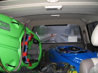
I went home, took a quick nap, and waited till Brandon got back from his meeting to go paddle something a little less gnarly. Adam decided to paddle Panther Creek, a Class IV+/V creek that runs in to the Wind River that afternoon and head home afterwards… Brandon got home around 11:00, but after looking at the weather report for that evening, I decided to head home early and miss the snowstorm. Check out my rig….
What do you do with three creek boats and a playboat when you need to drive about 175 miles and want to get good gas mileage and avoid being blown off the road from 60 mph winds?
YOU STUFF EM IN YOUR CAR!
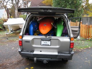
Puzzle-work by: Brandon Backman and Kim Russell
Photo by: Kim Russell
Seeing how my car only gets about 19 mpg on the highway on a good day with no weight, no boats or passengers in it, I figured having three creek boats on top of the car would mean some seriously bad gas mileage. (Not that having them in my car would be much better, but I figured it would be a good idea seeing the weather report called for crazy strong winds and lots of snow for the drive home). Plus, I was delivering two boats to some friends back in Bend and wanted to get them in the car if I could. :)
Needless to say, the boats made a great arm rest on the way home. Although it was about two feet higher than a normal armrest would be. Still awesome!!! I think I got about 16 mpg though. maybe. Ouch. At least gas prices are now $2.59 here and not $3.50.
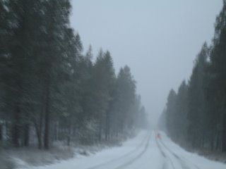
Photo by: Kim Russell
This is what I came home to ...... SNOW. And to think Mt. Bachelor opens Friday (today)!
I later learned that Adam’s run down Panther Creek went well, and that if anyone is ever thinking about putting in at the upper put-in don’t… It is class two for a few miles with a lot of long-jams that somehow you can paddle through, and adds about an hour or two onto the total trip. He got off the water just as it became dark and was able to make it home in good time even with a gnarly blizzard and bald summer tires!
(Sorry for the lack of kayaking photos folks…. It was hard to get pictures on the East Fork since there were no eddies and if I popped my skirt to take a photo at any point my boat would fill with water and I would swim… Didn’t really feel like doing that so not too many photos there. On the main white Salmon on the Husum Falls section, we wanted to get down before dark before we froze our bums off). Bummer.
Kim Russell
A.K.A. Kiddo
Thursday, November 09, 2006
MORE FLOOD PICTURES
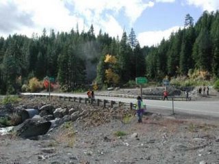
Oregon Highway 35:
White River Bridge on Oregon Highway 35 to Hood River (Kim Russell):
After: photo from kptv.com >
(This railing is about 3.5 feet high)
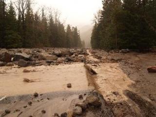
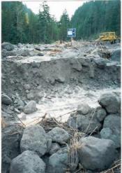
Heading West on 35, the road right before you reach the White River Bridge (in before/after previous pictures). There is usually asphalt there.
(Photo by kptv.com)
More Highway 35 erosion (photo by: kptv.com)
Pollalie Creek Crossing-After >
Both images are taken from http://www.fhwa.dot.gov/engineering/hydraulics/pubs/mthod/poster/poster.cfm
Newton Creek-After >
Both images are taken from http://www.fhwa.dot.gov/engineering/hydraulics/pubs/mthod/poster/poster.cfm
Various flood Photos from Across Oregon taken from: katu.com (news)
-Kim Russell-
ITS FLOODING!
This morning I woke up, did the normal check outside for snow thing, and got on the computer to check water levels. When I saw the page, I freaked out… More or less every river on the page was HIGH or at FLOOD STAGE. WHOA. That happened fast…
Rivers out here on the West Coast are blowing up! More like out actually. The Little North Santiam, which usually tops out at 3,000 cfs is at 15,000 cfs! The White Salmon is at 16 ft and rising, compared to the normal 3-4 feet. The river was at 3 feet two days ago! And today it’s at 16 feet! AH! Lake Creek (the creek with epic play that we like to tell people does not exist) is at 18.5 feet and rising! The Breitenbush is at 5,000 cfs compared to 1800! Everything is EXPLODING!
Photo by: Kim Russell
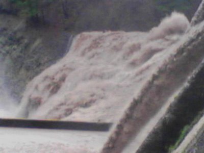
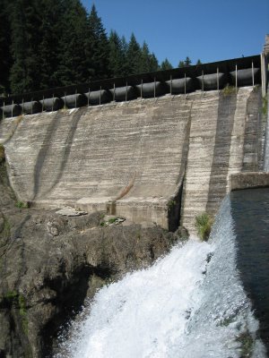
This is Condit Dam on the White Salmon at about 2 feet. No water is spilling over River Left and there is little water going over at the base of the picture. (Two days ago, the day looked something like this, only with a tad more water).
Photo by: Brandon Backman
This is Condit Dam today at about 16 feet. CRAZY!
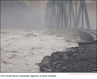
Roads are blowing out everywhere. Highway 35, the highway you take from Mt. Hood to Hood River, which has the East Fork of the Hood running alongside is underwater in some sections, so that has been closed. Apparently, Hood River has never seen this much rain! EVER! Most roads over on the coast are closed due to random mudslides and the road being underwater.
Swells in the Pacific off Oregon are expected to reach a 20 feet by tomorrow. Again, WOW!
This is insane! HAHA. Only, Bend is getting relatively NO rain compared to everywhere else. What is up with that!
All I know is there is some weird weather out here in the Northwest! As long as the whole state doesn’t end up underwater, life is good! Well actually, if it does, we could just paddle everywhere. Ha. It could work!
Anyway, who knows what is going to happen tomorrow! It’s time for me to get some plans together to go play in some chocolaty brown rivers this weekend!
Stay safe out there!
Kim
Photo by: Brandon Backman
Footage from Green Truss
Filmed by Brandon Backman:
-Over 'n' Out-
Kim Russell
:)
Riverhouse!
Swans Attack!
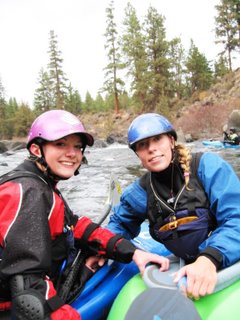
Kim Russell and Lisa Kloberdanz
Photo by: Jason Offett
After 6 months of working together at Alder Creek Kayak and Canoe, fellow Liquidlogic Lady, Lisa Kloberdanz and I had NEVER paddled together. Read NEVER EVER EVER! How sad is that? We work in the same shop and we both love to paddle and we were both paddling a lot over the summer, but our schedules never worked out for us to paddle together. Bummer!
BUT, Today, November 4, 2006, Lisa and I got a chance to paddle on the local Riverhouse run in town with some friends: John Cramp, John Jordan and Jason Offett. WOHOO!
Some of the Crew:
John Jordan
Photo By: Kim Russell
Jason Offett in his Jefe
Photo By: Kim Russell
Riverhouse is a solid class IV run that only runs during late/fall and winter. In the summer, water is released from Wickiup Reservoir and makes it way down to the city of Bend. When it gets about half-way through town though, the water is re-routed/piped out to various canals for farmers’ crops.
In the winter, these canals “shut down” and paddlers get their water back. The lower runs, Riverhouse and the Middle Deschutes, from Steelhead Falls to Lake Billy Chinook, go from something like 76 cfs in the summer (bone dry) to a fairly constant 500 cfs in the winter. SWEET! By the way, there will be a write up on the Middle Deschutes section sometime soon once we get on it. Anywhooo… today we ran “Riverhouse,” named at the hotel you put-in behind :)
Lisa Kloberdanz in her Mighty Green Liquidlogic Crossriver making her way downstream
Photo By Kim Russell
Today, though, we put-in at “the dam” this super fast, super cool 30 ft slide thing. Just sounds cool huh? While putting in, we noticed a bunch of swans gathering at the lip which brought out some really interesting “attack” stories from everyone. John Jordan told us about the time he was squirt boating and this one swam came over to him and made like he was going to attack. John was able to “make himself look bigger,” and the swan went away. John went back to his squirt boating and eventually the swan came back with four others ready to attack! Talk about feisty animals! Haha. WOW. Anywhoo.. back to the story…
Kim Russell running the dam
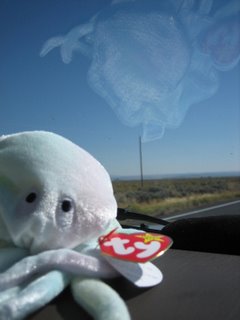
Photo by: John Cramp
Lisa took a pass on the dam due to her neck injury L Get better ASAP! Everyone else put in above the dam and took turns dropping over the edge. The second you drop over, you feel like you are going to go over-vert and land on your face. As long as you lean forward, you don’t. As you drop over, you get that feeling you get on a rollercoaster when you are going really fast down a BIG hill. You can feel your stomach rising as you pick up speed and brace for impact. You get to the bottom, and life is SWEET! Today, everyone made it down safely and we were able to make our way downriver to rapids with names such as The Wright Stuff, Flumes of Doom, T-rex, The Ogre. The Wright Stuff is basically a pin-fest. Haha. You either get pinned, flip on your face because of a new log that throws you off into more gnar triangular shaped weird slots between them rocks, or make it down only taking half the plastic of your boat in the process :)Naw. It’s not that bad, it’s just really pinny.
Next up, comes Flumes of Doom, a fun series of ledges, boulder-garden style with a fun boof at the bottom. T-Rex is another boulder garden ledgy type rapid. Super fun!
Jason Offett taking the Right line in T-Rex
Photo By: John Cramp
Kim Russell dropping into T-Rex
Photo by: John Cramp
Lisa Kloberdanz setting up for the next ledge in T-Rex
Photo By: John Cramp
(No pics of John Cramp or John Jordan here :( )
One of the last substantial rapids on this section is called the Ogre. It’s this semi-steep ramp into a funky curler/pillow along the right wall with a giant boulder in the middle of the river just downstream of the pillow and an eddy on the left mid-way between the two. SQUIRT FEST for me and Lisa in our playboats while the guys styled it in their creekers! WOHOO!
Check out the video taken by John Cramp of Jason Offett in his Jefe running the Ogre!
We all had a nice leisurely paddle and did the run in a little less than two hours I think. At the end, we were so stoked on finally paddling together, Lisa and I are planning to do so again tomorrow with another crew! Yee-haw!
Kim Russell
Wind River Video
Christina's Paddle Graphics
By:Christina Russell
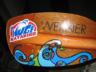
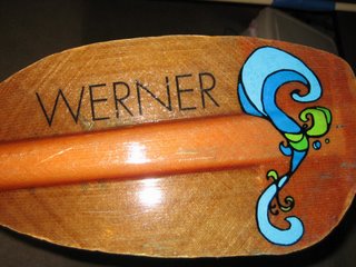
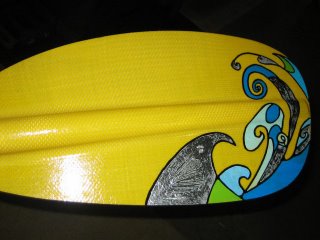
Hey well I thought I would show you guys what I've been working on lately... PADDLE GRAPHICS! It takes a bit of time but most of that is spent designing. I would tell you how to do it but then I would have to kill you...mwhahahhaha ;). Basically from start to finish it takes 6 hours.
*Just FYI...All designs are copyrighted Christina Russell*
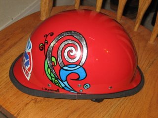
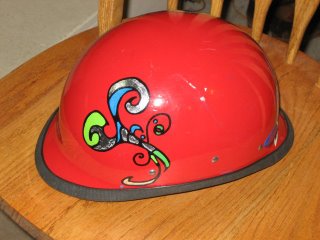
Here are some pics of a paddle I finished for the AT Team. (The grey on the paddle is actually silver leafing)
AT wanted a "guys" blade and a "gals" blade which ='s flowers...ugh
Oh yeah I experiemented on my helmet...the graphics have held up GREAT!
Anyhoooooo the paddle graphics are so fun to do! I'm still trying to find the best sealant....the one I'm currently using is tempremental.
Itching for some ditching!!!
By:Christina Russell
What do you do when you NEED To go kayaking? When every bone in your body is itching to boat? Leave that cubicle of work behind and hit the road jack!
A couple weeks ago it felt as though I had not been kayaking for ages...though it had only been a
one week hiatus. I decided that after a busy week at college it was time to take a road trip for some play :)....
I am new to the Boise area and though I have paddled alot here in Idaho, I'm not familiar enough with the flows. In a span of a few minutes time, i had figured out that A: no one was available to paddle. B: There were no playspots in (levels dropped faster than anticipated)and C: People were urged to stay inside because of the intense smoke (a 200,000 acre fire in Montana generously donated its smoke to Idaho.)
Alright...still cant stop me from boating! I made my gear baby (thank you Amy Lundstrom!)and grabbed the essentials. Essentials to me is defined as food (and lots of it), music, my co-pilot Wiggles *who I will introduce momentarily* and of course my gear. In general I think kayaking is best when you HAVE your boat!
Here is my co-pilot Wiggles. He is a fuzzy jellyfish who has adopted the dashboard of my car as his permanent home. Whats so great about Wiggles? He shuts-up when he knows he's wrong and never argues about my music choice...PERFECT-
After making a few phone calls, I decided to head to a ditch known as "The Gutter". My sister and I always hit the Gutter in the summer-Break out the snacks, music, and hit it! The playspot is in Horseshoe Bend and is one of three waves/holes in a canal. The Bladder is nextdoor... this inflatable dam creates the famous "Rubber Wave" when flows are high.
Supposedly the Gutter wasn't in, but no one at Idaho River Sports had been up there recently. Psh! I decided to go anyways and maybe I would hit a surf wave on the main Payette as well.
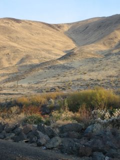
Sunrise over the hills near the Payette-
I headed out from good ol' Anderson Dorm of Albertson College at around 9 AM. The sunrise was gorgeous...smoke CAN be good sometimes. It was my first time back to the Gutter in a year and well...I had to ask for directions a couple times. Atleast Im not afraid to ask! Anyhoo I avoided the traffic jams that frequent the road to Horseshoe Bend and arrived at around 10 to find.....
I know what you're thinking...looks shallow right? Let me just put it this way...at the time I was paddling a Fun 1.5 and each time I tried to cartwheel, I hit the cement bottom. Not cool. The other two playspots were washed out so I worked on flatwater cartwheeling, stalls, and zero to hero's. No matter that the playspot wasn't in, I was in my boat and that's what mattered.
By the time I had pooped myself out, it was around 2 in the afternoon. I had heard that Climax wave might be in so I migrated up the road a bit. Unfortunatly it wasn't in either....time to head back I decided.
Though the trip was a "bust" in that nothing was in, I still had an awesome time. I grabbed a pint of Ben and Jerry's Brownie Batter icecream before heading back....mmmmmmm mmmmmm. It's the simple things ya know?!
In the spring when the Gutter and Climax come in, you know where i'll be! Christina over and out!
Ok time for a terrible joke...just cuz I can:
What did one strawberry say to another?
"If you weren't so sweet, we wouldn't be in this jam!" he he he he he